Process Transformation with GIS
Imagine a bustling city like St. Louis, Missouri, with countless parcels of land, all with unique characteristics and ownership. How do you filter that data to find the perfect spot for your green infrastructure investment? That’s where Flourish and Thrive Labs stepped in to help a green infrastructure company.
In 2019, the precursor to Flourish and Thrive Labs, Tabulae Spatial Services, was contracted by a green infrastructure company to conduct geospatial data analysis for the city and county of St. Louis. The objective was to develop a web mapping application enabling a green infrastructure company to identify potential investment opportunities.
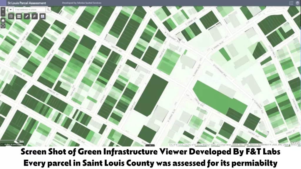
At Flourish and Thrive Labs, digital transformation is key to driving efficiencies and making informed decisions. That’s why we began the project by conducting listening sessions with the green infrastructure company team to understand their needs and requirements for a custom web mapping application. Through extensive data analysis, we determined the permeability of every parcel in St. Louis, enabling the client to understand better which parcels to target for potential green infrastructure investments. We leveraged the Semi-Automatic Classification Plugin for QGIS as well as NAIP imagery.
Permeability is an essential factor when it comes to green infrastructure investment. It refers to how well water can infiltrate the soil, which affects the ability of trees and other vegetation to grow. By determining the permeability of each parcel in St. Louis, we provided the client with a powerful tool for identifying potential green infrastructure investment opportunities.
We then matched the permeability data with parcel data, making it easy for the client to filter and sort parcels based on characteristics such as ownership, type of property, and more.
Leveraging the ArcIG Online platform, we built a custom web application that allowed our client to filter and sort parcels based on their specific criteria. The web application also enabled the client to calculate distances from a variety of different features such as schools or roads, as well as mark if they had done a site visit to a parcel, and track leads and prospects using their CRM.
The project’s challenges included the limited availability of data on permeability in the St. Louis region, requiring us to calculate that data for every parcel individually. Additionally, we were responding to the challenges faced by our client, who did not have an easy way to filter their prospects and leads.
To overcome these challenges, we employed a consensus workshop approach to understanding the current process as well as the ideal process for the client. After conducting a gap analysis, we developed a proposal for the technical solution, leveraging open-source tools and Esri mapping software to calculate the permeability of each parcel in St. Louis, which we hosted on ArcGIS Online.
The results of our work were numerous, including enabling a green infrastructure company to significantly reduce the time spent prospecting for potential green infrastructure investments. Additionally, the web application enabled the client to track if they had done a site visit to a parcel and perform basic math and calculations, saving them valuable time.
At Flourish and Thrive Labs, we believe that geospatial technology can be a powerful tool for driving process transformation. Our work with a green infrastructure company in St. Louis is just one example of how we leverage technology to drive efficiencies and make informed decisions.
We employed a consensus workshop approach to map out the current and ideal processes, identify areas for improvement, and develop an effective technical solution. We crafted a solution using SharePoint Online, Microsoft Teams, and Microsoft Power Automate, creating a streamlined system that tracks the status of permits and generates digital approvals to help the permitting process be effective.
Through collaboration with our client, we developed a custom web mapping application that enabled them to thrive and positively impact the community. Our work highlights the power of geospatial technology in driving efficiencies and making informed decisions.


