Our chief operations officer, Juliana McMillan-Wilhoit, recently delivered the keynote address at the 2023 Kansas Association of Mappers (KAM) conference. In her KAM keynote, she explored how geographic information systems (GIS) can enhance civic engagement and local democracy when applied thoughtfully.
However, many local governments still face barriers to fully leveraging GIS capabilities. She shared proven strategies to drive the adoption of location intelligence as a strategic asset, even when facing bureaucratic roadblocks. In this blog post, Juliana will recap her KAM keynote presentation’s key themes and actionable takeaways. She will also include links to helpful resources for putting these ideas into practice in your organization.
Now, let’s hand it over to Juliana to hear about her talk…
The Democratic Potential of Open Data
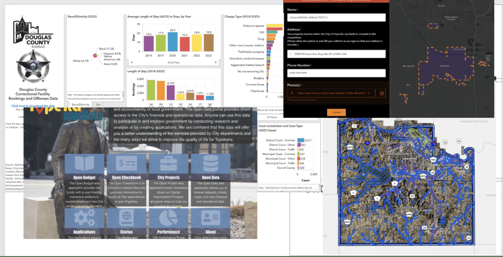
I began my talk by spotlighting how open data and interactive web maps can empower residents to participate in local decisions meaningfully. When citizens access the information guiding policies, inclusive discourse and collective action flourish.
I highlighted three organizations for their creative uses of GIS:
- Haysville, Kansas and their online Hub. This includes their Halloween Decorations Map.
- Topeka Open Data Portal
- Douglass County, KS GIS Portal
- Kansas City Board of Public Utilities

While many recognize GIS capabilities in theory, adoption lags in reality. My consulting experience has seen common barriers fall into three buckets. The next section of my talk went through each of those challenges and suggestions for how to overcome them
I offered proven tactics to tackle each challenge:
Build Awareness through Networks
One major obstacle to fully leveraging GIS is limited awareness of its capabilities. When technologists operate in silos, perspectives narrow. Vast potential remains untapped without understanding the diverse ways location intelligence can strengthen organizations and serve communities.
Expanding horizons requires looking beyond your daily role. Open up to new possibilities by connecting with the vibrant geospatial community. Build relationships with peers to explore use cases and brainstorm ideas.
There is immense power in networks. Your colleagues are out there, waiting to collaborate. But first you need to reach out. Here are some ways to get started:
- Join the weekly #GeoSpatialConnections chat on LinkedIn. Request to join our group and you’ll see the weekly audio event.
- Connect with others online. I would love to connect with you on LinkedIn!
- Send follow-up emails after the conference, including using the “delay send” feature.
- Attend the Lunch & Learn Webinars from KAM
- Attend my Mappy Hour networking events for lunchtime virtual networking!
- Start reading industry publications like ArcNews and GeoSpatial World
Show Relevance through Targeted Pilots
Even when you understand GIS capabilities, driving adoption also requires effectively conveying relevance and value. In organizations juggling many priorities, technologists often struggle to showcase how location intelligence can accelerate top objectives.
Breaking through stagnation requires blending persistence with compelling communication. You must intimately understand leadership goals and pain points. Then, tailor your pitch.
Make an evidence-based case for how GIS helps leaders achieve their mission. Avoid leading with technical features. Instead, connect directly to motivators like efficiency, cost savings, and community impact.
Here are some proven tactics to communicate the immense value you bring to the table:
- Develop an elevator pitch explaining your value using this formula: “My service helps X audience by doing Y so that they can achieve Z outcome.” Keep it concise but compelling.
- Identify leadership priorities through regular check-ins and reviewing internal communications.
- Use downtime for “passion projects” showcasing solutions to leadership needs. Start small without perfectionism to get proof of concepts in leaders’ hands.
- Quantify benefits with metrics focused on efficiency, cost savings, and impact. Make the case with specifics.
- Leverage storytelling with visuals demonstrating real-world improvements from GIS implementation.
- If you’d like to work through communicating relevance more, I offer 1:1 Career Coaching sessions that can help tailor strategies to your situation. You can book a session or you can learn more about our coaching here.
Navigate Bureaucracy with Empathy
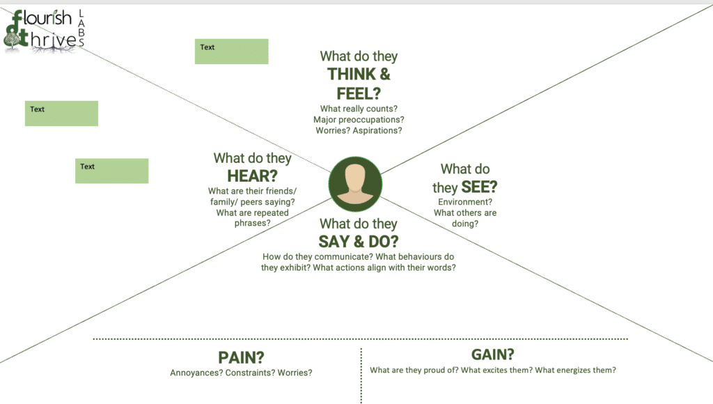
Even with leadership support, entrenched organizational bureaucracy can derail progress. Policies and procedures evolve for a reason – to protect the institution’s health. Rather than avoid them, seek to understand. Approach rules with empathy, not antagonism. Use tools like empathy mapping to uncover the humans behind the roles. Discover the emotions, environments, and experiences driving behaviors.
With this wisdom, adapt processes rather than resist them. Work creatively within guardrails. Demonstrate you comprehend the spirit behind policies. When change agents operate with empathy and emotional intelligence, they gain trust and influence. Progress within system bounds becomes possible.
If you’re looking to do empathy mapping in your organization, did you know that F&T Labs offers a one-day workshop?
As you aim to advance GIS capabilities, remember that culture shift starts from within. Here are proven methods to steer initiatives through implementation:

- Use an empathy map to understand the motivations behind policies. This visual framework explores perspectives by answering key questions like:
- What do they think and feel?
- What do they see as successes or failures?
- What do they hear from peers and colleagues?
- What motivates them personally and organizationally?
- What are their pains and gains?
- Mapping stakeholder empathy reveals the humanity within roles. You gain a holistic view of the emotions, experiences and environments influencing their decisions.
- With deeper understanding through empathy, policies seem less senseless. You can adapt processes rather than avoid them.
- Download my Empathy Map Template as a PowerPoint or PDF to try this exercise.
Closing thoughts in the KAM Keynote
In closing, location intelligence holds tremendous potential to strengthen local democracy and empower communities when applied thoughtfully. However, driving adoption requires overcoming common hurdles through creativity, empathy, and purpose-driven leadership.
Begin by expanding your awareness of GIS capabilities. Show relevance to leadership priorities through targeted pilots. And navigate bureaucracy by understanding motivations and adapting processes.
As you aim to transform your organization, remember that change starts with culture.
How F&T Labs Can Help You!
We hope that you can get some great insights from the Kansas Association of Mappers (KAM) Keynote.
Flourish & Thrive Labs is a woman and disabled-owned small business firm created by and for public servants. We specialize in organizational transformation – implementing new systems and evolving mindsets and processes. Our proven THRIVE methodology sets the tone for all of our engagements. And we take a people-first approach to everything that we do.
We have three offerings that may be of interest to you:
- Our day-long engagement workshop.
- Our Data Modernization Maturity Model for Public Sector
- Career Coaching
Our unique consulting approach and contracting capabilities can accelerate your GIS adoption journey. We would love the opportunity to have a discovery call to learn more about how we can assist your organization in fully leveraging GIS to serve communities. Reach out to discuss your goals and how we can support you on the path forward or email us!

